Why a River Bends Instead of Running Straight
Why a river bends instead of running straight is easier to read with a simple field sketch: separate bank clues from channel shape and compare both.
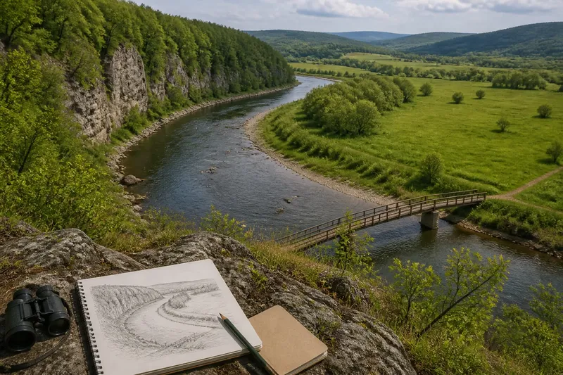
Why a river bends instead of running straight is easier to understand from a bend with a rock ledge on one side and a broad, shallow shelf on the other. The contrast is not a neat exchange of soil from bank to bank; it is a channel finding a winding route through uneven ground.
Say you arrive at a grassy valley stream with a bend around a willow thicket. You note the rock ledge, the shallow shelf and a narrow opening in the vegetation downstream; by sketching the channel’s shape and the ground around it, you can distinguish a constrained bend from one with room to wander.
Why does a river bend instead of running straight?
Water follows the slope available to it, but a valley floor is rarely a perfectly even ramp. Hard and soft patches, roots, boulders and small changes in channel depth can steer the flow unevenly, giving a slight curve a chance to develop.
Once the channel curves, its flow takes a winding path. Water is directed toward the outer part of a bend, while shallower deposits may accumulate along the inner side. These features can appear together, but they are not a tidy conveyor belt that moves equal amounts of ground from one bank to the other.
The bend’s shape also depends on what contains it. A stream crossing a broad, soft valley floor has different room to shift than one confined by bedrock, a steep valley wall or a human-built boundary.
How can you tell whether the valley is steering the channel?
Look beyond the water’s edge. A bend pressed against a rock wall or a narrow valley side has less room to change direction than one surrounded by a broad, low floodplain. Bedrock outcrops, steep slopes and built structures are useful clues to those limits.
Then follow the valley floor upstream and downstream. If the channel’s broad curves follow the shape of the valley, the landform may be guiding the route. If the valley opens out while the channel remains sharply confined by a hard edge, local geology or construction may be doing more of the steering.
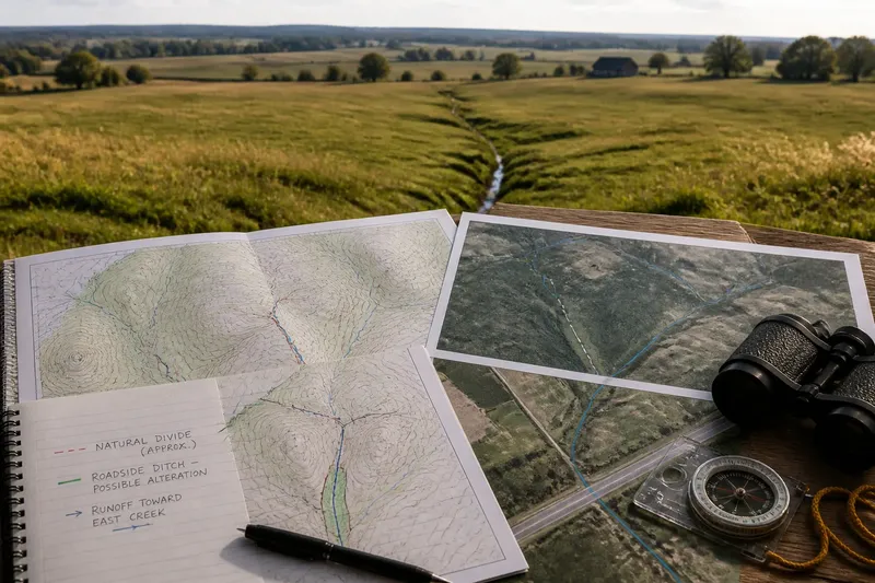
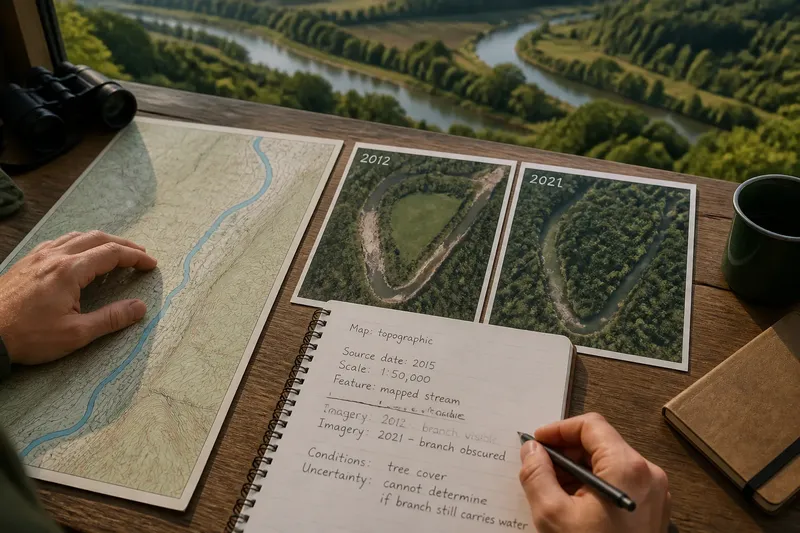
A map can help, but it cannot replace the ground view. Aerial imagery shows the larger pattern; a field sketch records details such as rock, roots, banks and nearby structures that may be too small or obscured to interpret from above.
What should you record when reading a bend?
Keep the notes focused on observations rather than a prediction about where the river will go. Use a field notebook, pencil and a simple map or aerial image, and record the viewing position so a later observer can compare the same reach.
- Channel outline: Sketch the bend and nearby straight reaches. If the curve follows a steep valley wall, note that the valley may constrain its route; if open ground borders it, note that more room is available.
- Valley shape: Mark rock outcrops, steep sides and broad flat areas. If hard ground borders the channel, expect less room for lateral change; if the valley floor is broad and low, record that it offers more space.
- Nearby structures: Note roads, walls, bridges or other built edges. If one sits close to the bank, treat it as a possible constraint; if none is nearby, do not infer that the channel is free from natural limits.
- Water-level context: Write down whether the water is high, low or visibly changing. If conditions obscure the bank or channel bed, postpone fine-grained interpretation; if the edge is clear, describe only what is visible.
- Viewpoint and date: Record where and when the sketch was made. If you revisit from the same safe viewpoint, compare channel shape; if the view has changed, mark the comparison as uncertain rather than treating it as evidence of movement.
- Visible channel features: Note ledges, shoals, islands or abrupt changes in depth where observable. If a feature appears to steer the channel, mark it as a possible influence; if its role is unclear, leave the cause open.
What questions help distinguish different kinds of bends?
Does a bend always mean the river is changing course?
No. A curved channel describes its shape, not how quickly or whether that shape is changing. A single visit can show the form, but comparison from a consistent viewpoint is needed to describe change.
Can bedrock hold a river in a winding route?
Yes, a channel can curve while remaining bounded by resistant rock or a steep valley side. In that setting, the surrounding landform may help explain the route without showing that the bend is migrating across a broad valley floor.
What is the difference between a bend and an oxbow lake?
A bend is a curve in an active channel. An oxbow lake is a water body left when a former channel curve has been cut off from the main route; a crescent-shaped pond alone is not enough to establish its history.
Can a map explain why a river bends?
A map can reveal the valley’s broad shape and show how the channel sits within it. For local causes, check the ground for bedrock, slopes, obstacles and built boundaries that the map may not show clearly.
How do you turn field notes into a useful reading?
Imagine you sketch a stream bend beside a steep rock wall, with a broad grassy flat on the opposite side and a footbridge near the bend. Your notes record a low, clear view of the channel, the wall’s position and the bridge’s location; you then compare the sketch with an aerial image and find that the channel follows the valley’s edge.
The resulting reading is that the rock wall and valley shape constrain the route, while the bridge is a possible local boundary to consider. The notes do not establish that the channel has moved or predict what it will do next; they clarify which physical features may be shaping its present course.
What is not worth the effort?
Do not try to infer a river’s history from one striking feature, such as a crescent-shaped pond, a single shoal or a leaning tree. Those details can prompt a question, but without the surrounding landform and a clear record of the channel, they do not settle the cause.
For why a river bends instead of running straight, the most useful conclusion is often about its setting: the curve may reflect uneven ground, a winding flow path or limits imposed by the valley. A careful sketch can show which explanation fits the visible landscape—and where the evidence stops.